

GPS Coordinates – S 24º 31.860′ and E 27º 29.896′
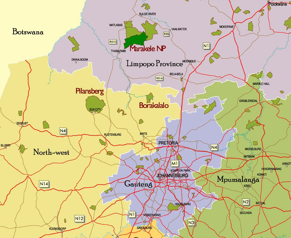
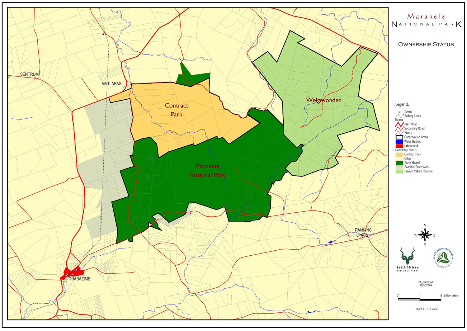
- The park is situated in the Waterberg mountain range in the Limpopo Province (formerly Northern Province) near Thabazimbi, approximately 250km north of Johannesburg, in a malaria-free area.
- Driving distances to Marakele: from Gauteng is 4 hours and from Tshwane 3 hours.
Travellers can take either:
- the N1 to Bela-Bela (Warmbaths) and from there follow the R516 via Mabula and Leeupoort to Thabazimbi
- or travel to Brits and follow the R511 via Beestekraal to Thabazimbi.
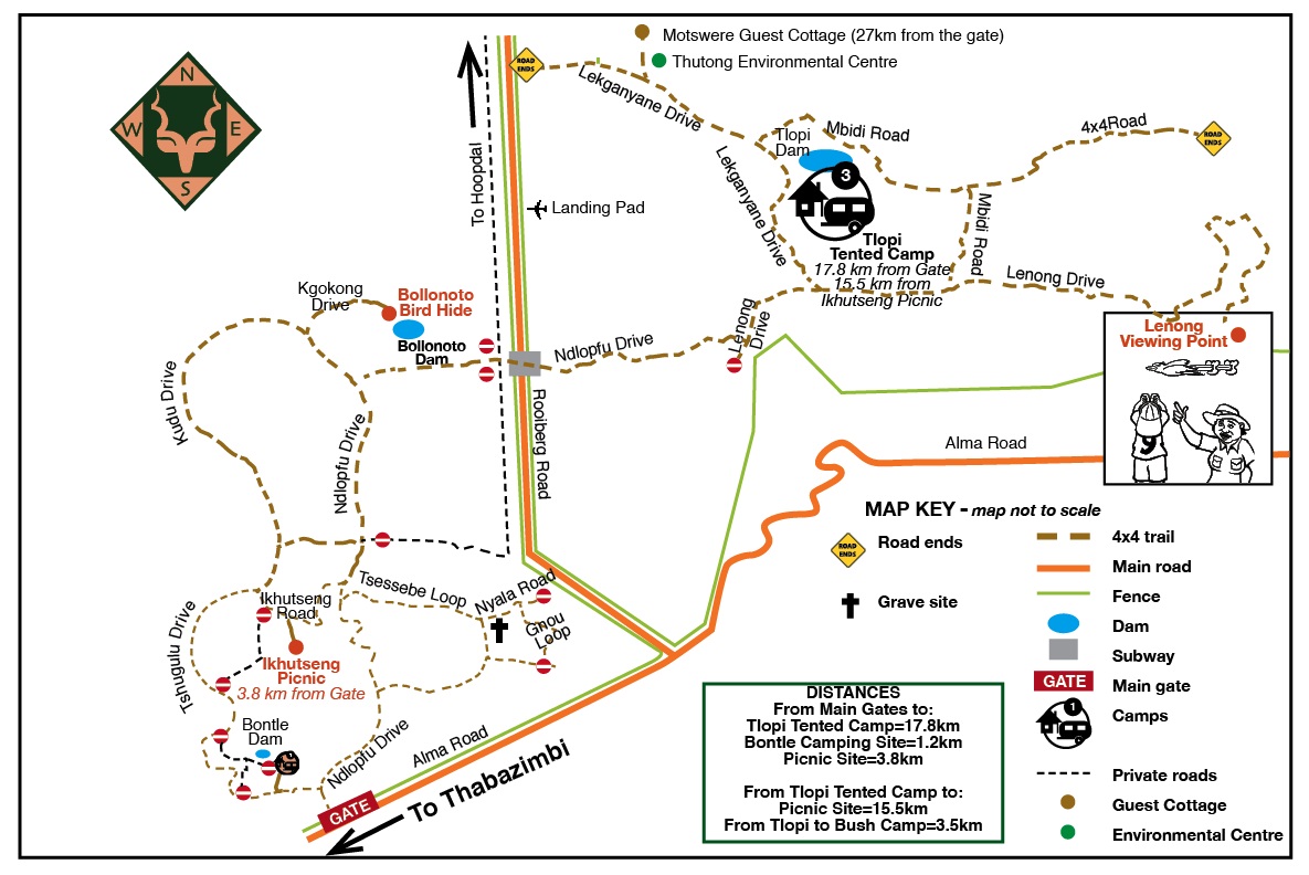
- The office is approximately 12km from Thabazimbi crossing on the road from Thabazimbi to Alma.
- People in sedan vehicles might find the road conditions in certain areas of the park (main road) a bit challenging but the park is working on the major road revamp and the information will be updated as soon as the new development has been completed. Travelling times inside the park to get to any accommodation facility is between 07:OO and 18:OO and strictly no driving after 18:OO.
S 24º 31.860' and E 27º 29.896'
Courtesy of SANParks.